43 years after Borah Peak quake, Challis and Mackay still bear its marks
The magnitude 6.9 earthquake that struck central Idaho on October 28, 1983, killed two children and damaged dozens of buildings in Challis and Mackay.
By Justin Brooks ·
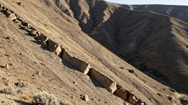
At 8 a.m. on October 28, 1983, the ground began shaking beneath Borah Peak, Idaho's tallest mountain. The magnitude 6.9 earthquake, now called the Borah Peak Earthquake, struck the central Idaho communities of Challis and Mackay. It originated along the Lost River Fault at a depth of nearly 10 miles.
The quake lifted the Lost River Mountains while lowering the Thousand Springs Valley. According to Idaho's Office of Emergency Management, the mountains and valley shifted apart by nearly 14 feet in some places. The shaking also altered groundwater flow, opened cracks in the ground, and set off rockslides and landslides in the area.
Two children died in the event. The Office of Emergency Management reports that the brick and block masonry in Challis and Mackay crashed to the ground. A storefront collapsed and buried two schoolchildren, ages 6 and 7. People nearby rushed to uncover them but could not save them. These were the only deaths attributed to the quake.
Property damage across the region exceeded $12 million. The U.S. Geological Survey reports that the most severe damage occurred in Challis and Mackay. In those towns, 11 commercial buildings and 39 private houses sustained major damage, and 200 houses sustained minor to moderate damage.
The earthquake also left a permanent mark on the terrain. Surface faulting created a 35-kilometer zone of fresh scarps and ground breakage along the southwest slope of the Lost River Range. The U.S. Geological Survey reports vertical displacement of up to 2.7 meters between Mackay and Challis. The most extensive breakage ran along an 8-kilometer zone between West Spring and Cedar Creek, where the ground surface broke into randomly tilted blocks several meters wide.
The 20-mile-long fault scarp remains visible today along the base of the Lost River Range in central Idaho.
Source: KBOI · original report published